Sentinel-2A (S2A) was launched on 23 June 2015 and provides wide area optical imagery with 10 m (visual and near-infrared), 20 m (red-edge, near and short-ware infrared) and 60 m
(visual to short-wave infrared for atmospheric correction) resolutions from October 2015 onwards. The S2A has wide swath width (290 km) and a 10-day revisit frequency over global
land masses.
Identical S2B unit of S2 was launched on 07 March 2017, increasing the revisit capacity to 5 days for S2.
The Copernicus programme already foresees C and D versions of these
Sentinels to guarantee data availability until, at least 2027 and, provisionally, "next generation" versions beyond that.
The recent availability of time series of Sentinel-2 imagery represents a significant technological step in the use of Earth Observation (EO) data for forest cover monitoring.
The 5 days revisiting time (S2A and S2B satellites) and the 10 m spatial resolution imply the need for much larger storage and processing resources than ever.
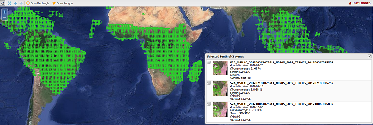
To facilitate the use of Sentinel-2 imagery by national forestry services in the tropics (in particular in relation to REDD+ activities),
the JRC has developed the Sentinel-2 web platform, an online Web system which is aimed at browsing, exploring and processing the full dataset of
Sentinel-2 imagery available over the Tropical belt.
Sentinel-2 web platform implements different strategies to guide users in searching the most suitable images by offering: