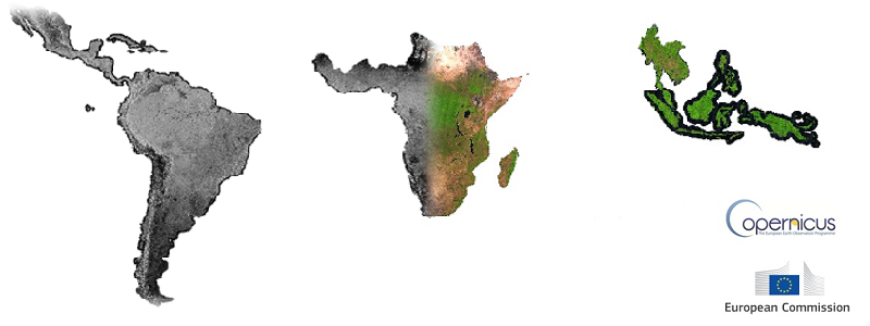
The ensemble of the first two Sentinel sensor platforms constitutes a unique European monitoring capacity for land surface characterization that can be applied globally and consistently to forestry applications. While technical superior to any other current monitoring capacity, the interoperability with the US Landsat 8 and possible other sensors that may provide high resolution imagery under "free and open" licenses, will further increase essential data availability.
The recent availability of time series of imagery from the Sentinel satellites represents a significant technological step in the use of Earth Observation (EO) data for forest cover monitoring. The 5 days revisiting time of the Sentinel-2 platform (S-2 A and S-2B satellites) and the 10 m spatial resolution of the Sentinel-2 optical imagery imply the need for much larger storage and processing resources than ever.
Besides optical data from Sentinel-2, also radar (SAR) data from Sentinel-1 platforms is needed systematically as additional information layer and for areas with persistent cloud cover (see for example Verhegghen et al. 2016 [4]).
To facilitate the use of Sentinel's imagery by national forestry services in the tropics (in particular in relation to REDD+ activities), the JRC has developed:
Processing of Sentinel-2 and Sentinel-1 composite has been performed in the Google Earth Engine platform [5].
Background reading and web sites:
[1] Simonetti D., Simonetti E., Szantoi Z., Lupi A., and Eva H. D., 2015 First results from the phenology-based synthesis classifier using Landsat 8 imagery IEEE Geoscience and remote sensing letters https://publications.jrc.ec.europa.eu/repository/handle/JRC95065
[2] Simonetti D., Marelli A., Rodriguez D., Veselin V., Strobl P., Burger A., Soille P., Achard F., Eva H., Stibig H.J., Beuchle R., 2017 Sentinel-2 web platform for REDD+ monitoring, online web platform for browsing and processing Sentinel-2 data for forest cover monitoring over the Tropics. Luxembourg: Publications Office of the European Union, EUR28658; doi:10.2760/790249 https://ec.europa.eu/jrc/en/publication/sentinel-2-web-platform-redd-monitoring-online-web-platform-browsing-and-processing-sentinel-2-data
[3] Simonetti D., Marelli A., Eva H.D., 2015 IMPACT: Portable GIS toolbox image processing and land cover mapping Luxembourg: Publications Office of the European Union, EUR 27358 EN, ISBN 978-92-79-50115-9 https://publications.jrc.ec.europa.eu/repository/handle/JRC96789
[4] Verhegghen A., Eva H.D., Ceccherini G., Achard F., Gond V., Gourlet S., Cerutti P.O., 2016 The Potential of Sentinel Satellites for Burnt Area Mapping and Monitoring in the Congo Basin Forests Remote Sensing 2016, 8, 986; doi:10.3390/rs8120986 https://www.mdpi.com/2072-4292/8/12/986/
[5] Gorelick N., Hancher M., Dixon M., Ilyushchenko S., Thau D., Moore R., 2017 Google Earth Engine: Planetary-scale geospatial analysis for everyone Remote Sensing of Environment, ISSN 0034-4257 https://doi.org/10.1016/j.rse.2017.06.031