 Balk, D., Pozzi, F., Yetman, G., Deichmann, U. and Nelson, A. 2004.
The distribution of people and the dimension of place: methodologies to improve the
global estimation of urban extents. Working Paper, CIESIN, Columbia University. Palisades,
NY. pp 31.
Center for International Earth Science Information Network (CIESIN), Columbia University; International Food Policy Research Institute (IFPRI); The World Bank; and Centro Internacional de Agricultura Tropical (CIAT). 2004. Global Rural-Urban Mapping Project (GRUMP), Alpha Version: Settlement Points. Palisades, NY: Socioeconomic Data and Applications Center (SEDAC), Columbia University.
Deichmann, U. 1997. Accessibility Indicators in GIS. Department for Economic and Social Information and Policy Analysis. United Nations Statistics Division. pp 24.
Farrow, A. and Nelson, A. 2001. A Simple and Flexible GIS Tool for Deriving Accessibility Models. Internal Document, CIAT, Cali, Colombia.
Geertman, S.C.M. and Ritsema van Eck, J.R. 1995. GIS and models of accessibility potential: an application in planning. International Journal of Geographic Information Systems 9, 67-80.
Nelson, A. 2000. Accessibility, transport and travel time information. CIAT Hillsides Project Report, CIAT, Cali, Colombia. pp 16.
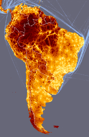
Nelson, A. 2008. Travel time to major cities: A global map of Accessibility. Global Environment Monitoring Unit - Joint Research Centre of the European Commission, Ispra Italy. Available at https://gem.jrc.ec.europa.eu/
Nelson, A. and Leclerc, G. 2007. A spatial model of accessibility: Linking population and infrastructure to land use patterns in the Honduran Hillsides. In Hall, C. and Leclerc, G. (eds), Making World Development Work: Scientific Alternatives to Neoclassical Economic Theory. University of New Mexico Press, Alburquerque, NM. USA.
Pozzi, F. and Robinson, T. 2008. Accessibility Mapping in the Horn of Africa. IGAD Livestock Policy Initiative Working Paper. FAO, Rome. pp 44.
Uchida, H. and Nelson, A. 2008. Agglomeration Index: Towards a New Measure of Urban Concentration. In: Guha-Khasnobis, B. (Ed), Development in an Urban World, UNU-WIDER, pxxx-xxx.
Uchida, H. and Nelson, A. Agglomeration Index: Towards a New Measure of Urban Concentration. Background paper for the World Bank's World Development Report 2009.
van Wagtendonk, J. W. and Benedict, P. R. 1980. Travel time variation on backcountry trails. Journal of Leisure Research 12 (2): 99-106.