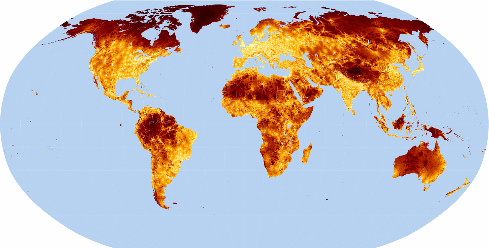
 The data are in geographic projection with a resolution of 30 arc seconds. The format is integer
ESRITM GRID format with pixel values representing minutes of travel time.
The files are stored in a zip archive. The archive also contains an ESRITM Shapefile of the
populated places. Other files include Metadata (XML), and ArcView 3 Projects and Legends (APR and AVL).
The data are in geographic projection with a resolution of 30 arc seconds. The format is integer
ESRITM GRID format with pixel values representing minutes of travel time.
The files are stored in a zip archive. The archive also contains an ESRITM Shapefile of the
populated places. Other files include Metadata (XML), and ArcView 3 Projects and Legends (APR and AVL).
Nelson, A. (2008) Estimated travel time to the nearest city of 50,000 or more people in year 2000. Global Environment Monitoring Unit - Joint Research Centre of the European Commission, Ispra Italy. Available at products/gam/ (accessed dd/mm/yyyy)
| Dataset name | Data download | Image link |
|---|---|---|
| Estimated travel time to the nearest city of 50,000 or more people in year 2000 | Download | Image |
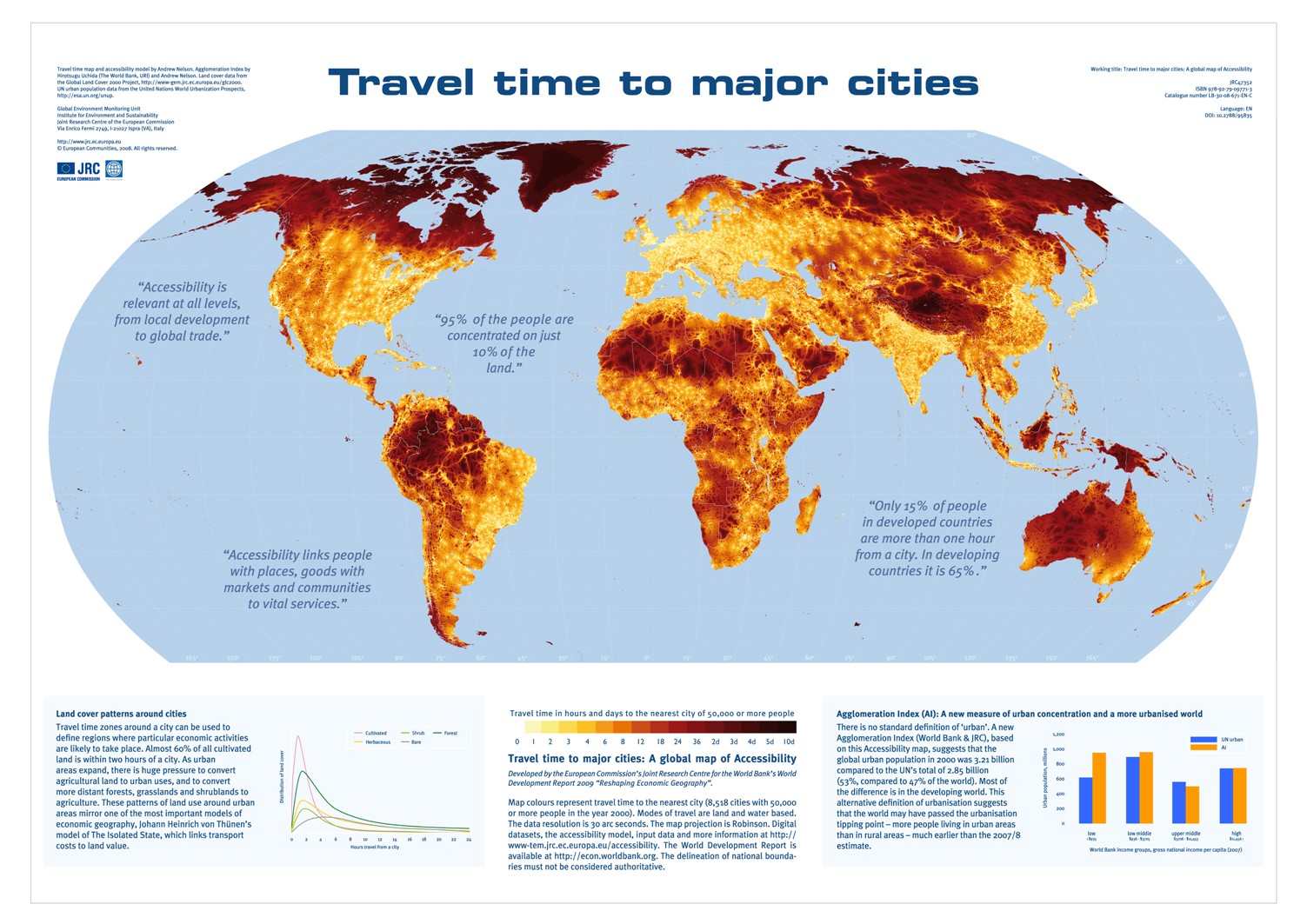
 This is an A0 sized poster of the global accessibility map in PDF format. It includes some general results
from the Agglomeration Index analysis and a study of land cover patterns around cities.
This is an A0 sized poster of the global accessibility map in PDF format. It includes some general results
from the Agglomeration Index analysis and a study of land cover patterns around cities.
Nelson, A. (2008) Travel time to major cities: A global map of Accessibility. Office for Official Publications of the European Communities, Luxembourg. DOI:10.2788/95835, ISBN:978-92-79-09771-3.
| File name | File download | Image link |
|---|---|---|
| Travel time to major cities: A global map of accessibility | Download | Image |