The FCDM tool supports the detection of forest canopy disturbance from satellite remote sensing and can provide indication on forest degradation processes. Reporting on forest degradation is required by many tropical countries participating in the REDD+ (Reducing Emissions from Deforestation and Degradation) program. However, compared to deforestation, the mapping of ‘forest degradation’ has proven to be technically much more challenging and the signal of a forest canopy disturbance is less prominent, as it does not result in a change of land cover.
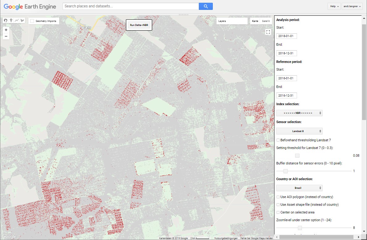
The FCDM tool developed at the JRC uses a change detection approach based on the difference (delta) of the self-referenced ‘Normalized Burn Ratio’ index (Delta-rNBR; Langner et al. 2018), detecting forest canopy change over defined periods at pixel and sub-pixel level (Figure 1). The underlying Delta-rNBR index allows the detection of forest canopy disturbance within tropical evergreen forest canopies (‘forest remaining forest’), resulting for instance from the tree removal, felling damages or from logging trails and leading. The freely available FCDM tool runs under Google Earth Engine (GEE) and allows the user via a specific GEE user-interface to calculate the Delta-rNBR index over any desired area by choosing the main parameters from simple drop-down menus, without the need of knowledge in scripting.
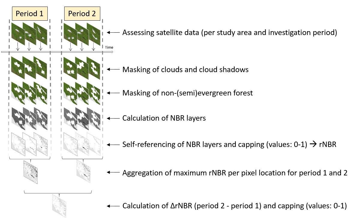
Forest canopy disturbance can be detected at much higher consistency and reliability levels when using whole periods within the FCDM tool instead of single dates, e.g. including all image acquisitions available in the Landsat or Sentinel-2 archive for whole seasons or whole years, and capturing canopy disturbances even if occurring only occasionally. The main processing steps applied within the FCDM tool are shown in Figure 2.
Through a scientific cooperation within the CEEJA project (Citizens Engaged in Environmental Justice for All) initiated in the framework of the ReCaREDD project, a study was carried out to identify recent deforestation and forest degradation activities occurring within the Prey Lang Wildlife Sanctuary, Cambodia, using Sentinel-1 satellite imagery from the Copernicus programme.
This assessment was made possible through the development of a new radar-based monitoring approach using Copernicus Sentinel-1 data (FCDM-radar).It will be added to the Forest Canopy Disturbance Monitoring (FCDM) tool that already includes the optical-based Delta-rNBR approach. This new FCDM-radar approach allows producing reliable and accurate information about ongoing deforestation and forest degradation activities at a very fine spatial resolution of 10 m.
JRC Technical Report:
![]() Forest encroachments and logging activities within the Prey Lang Wildlife Sanctuary, Cambodia
Forest encroachments and logging activities within the Prey Lang Wildlife Sanctuary, Cambodia